
 By
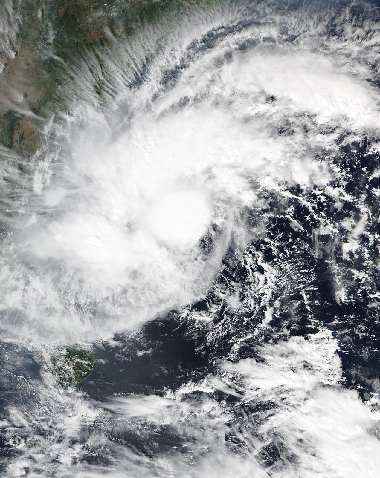
Cyclone Akvan has strengthened into a severe cyclonic storm as it crawls towards the Andhra Pradesh coast, where heavy to extremely heavy rain, a storm surge of up to two metres and winds gusting to 120 kmph are forecast for Thursday and Friday — the third cyclone to threaten the state in about a month.
By The BNN Media
The Best News Network
News Beyond the Borders
NEW DELHI, India — Cyclone Akvan strengthened into a severe cyclonic storm over the Bay of Bengal on Wednesday morning and is forecast to cross the Andhra Pradesh and Yanam coasts between Nellore and Visakhapatnam around noon on Friday, 20 November, the India Meteorological Department (IMD) said. Winds of 100–110 kmph, gusting to 120 kmph, heavy to extremely heavy rainfall and a storm surge of up to two metres are expected along the coast as the storm comes ashore.
Where the Storm Is
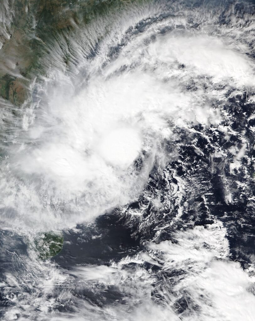
At 5.30 am on Wednesday, Akvan was centred about 580 km east of Chennai, 610 km south-east of Machilipatnam, 610 km south-southeast of Visakhapatnam and 730 km south of Gopalpur in Odisha, according to the IMD.
The storm is in no hurry. It has been crawling north-northwestwards at just 3 kmph — a fraction of the double-digit speeds at which cyclones usually move — and used the overnight hours to strengthen from a cyclonic storm into a severe cyclonic storm. Its slow pace has kept it over the warm waters of the Bay of Bengal for longer, but it has also given it more time to run into conditions that are now working against it.
A slow storm is not a weak storm: Akvan’s crawl means the rain it brings will fall on the same districts for longer.
A Forecast Scaled Down — But Not Called Off
The IMD has significantly scaled back its forecast of how powerful Akvan will be at landfall. Earlier projections had the storm crossing the coast as a very severe cyclonic storm, with maximum sustained winds of 120–130 kmph gusting to 145 kmph, between Nellore and Tuni.
In its latest bulletin, the weather agency now expects landfall as a severe cyclonic storm — one step down — with maximum sustained winds of 100–110 kmph and gusts of up to 120 kmph, crossing the coast in the Nellore–Visakhapatnam sector around Friday noon.
The downgrade is the result of the environment the storm is moving into. Akvan has entered a zone of increasing vertical wind shear, where wind speed and direction change with altitude; strong shear can tilt and disrupt a cyclone’s towering cloud structure. The waters closer to the Andhra Pradesh–Odisha coast are also relatively cooler, at around 28°C, compared with the 29–30°C waters over the deeper Bay where the system began.
The downgrade changes the wind forecast, not the danger: the IMD has kept its rainfall and storm-surge warnings in full force.
Rain: The Greater Threat
The IMD has retained its forecast of heavy to very heavy rainfall at a few places, with isolated extremely heavy falls, over Coastal Andhra Pradesh and Yanam on Thursday and Friday, coinciding with the cyclone’s approach and landfall. Isolated extremely heavy rainfall means falls of 21 cm or more in a day.
The rain warnings extend beyond the coast and beyond the two landfall days:
- Wednesday, 18 November: light to moderate rain at many places, with isolated heavy rain over Coastal Andhra Pradesh and Yanam
- Thursday and Friday, 19–20 November: heavy to very heavy rain at a few places and isolated extremely heavy rain over Coastal Andhra Pradesh and Yanam; isolated heavy rain over Tamil Nadu, Puducherry and Karaikal on Thursday, and over Rayalaseema on both days
- Friday and Saturday: Telangana could receive isolated to very heavy rainfall
- Saturday, 21 November: rain easing to light to moderate at many places, with isolated heavy rain over north coastal Andhra Pradesh
For Tamil Nadu, Akvan could turn out to be something of a near miss in terms of assured rainfall: nearly 600 km from Chennai on Wednesday morning, the cyclone is better positioned to deliver its rain to the Andhra Pradesh coast and adjoining parts of Odisha. Model forecasts suggest easterly flows could still bring fresh rainfall to the Tamil Nadu coast after the storm passes.

Storm Surge and a Rough Sea
The IMD has warned of a storm surge of up to two metres above the astronomical tide, which could inundate low-lying areas of Prakasam, Bapatla, Krishna, West Godavari, Konaseema and Kakinada districts at the time of landfall. The peak surge is expected over Bapatla, Krishna and West Godavari districts from Friday morning until the afternoon. (Note: the IMD’s 17 November bulletin put the surge at 1.0–2.0 metres; a later bulletin cited in some reports put it lower, at 0.4–1.2 metres — the figure used here is the higher, earlier bulletin figure.)
The sea off the coast is forecast to turn very rough to high, with wave heights rising sharply from Thursday evening until landfall. Thunder squalls with winds of 60–70 kmph, gusting to 80 kmph, are forecast over Coastal Andhra Pradesh and Yanam on Wednesday, gathering force to 100–110 kmph with gusts to 120 kmph on Thursday and Friday.
Odisha, which lies just north of the forecast landfall zone, is also bracing. The IMD expects winds of 40–50 kmph in Odisha on Thursday, rising to 50–60 kmph on Friday and Saturday, with the sea remaining rough until 21 November. The Odisha government has restricted beach tourism, boating, water sports and pleasure cruises along its coast until the situation is declared safe.
For fishing families and low-lying coastal villages, the surge and the rain together are the danger — not the wind speed alone.
Preparations on the Ground
Andhra Pradesh has been on alert since the start of the week. Chief Minister N. Chandrababu Naidu on Monday directed officials to take precautionary measures in view of the cyclone expected to affect the coastal regions on 20 November.
The Andhra Pradesh State Disaster Management Authority has said the cyclone’s movement is being continuously monitored. Its managing director, Prakhar Jain, said in an update on Wednesday morning that the storm had moved at just 3 kmph over the previous six hours. State Home Minister V. Anita reviewed the situation as Akvan intensified and directed the state machinery to remain on high alert for the next 48 hours.
Reports on Wednesday morning said 173 fishing boats were still to return to shore, and coastal districts are preparing relief camps, securing fishing and aquaculture assets and moving disaster-response teams into place. Odisha has flagged pre-emptive evacuations of vulnerable coastal and landslide-prone communities.
The Third Storm in a Month
Akvan is the third cyclone system to threaten Andhra Pradesh in about a month during the ongoing north-east monsoon, a rare cluster that officials have linked to El Niño conditions. Its predecessor was Cyclone Arnab, and the repeated battering has left damaged roads, power lines and farm structures that could raise the risk of wider flooding, crop losses and longer recovery times from this storm.
Beyond Akvan, the outlook for the rest of the Bay of Bengal cyclone season is unsettled. The US Climate Prediction Centre’s model forecasts show no potential area of cyclone formation until 8 December, while the European Centre for Medium-Range Weather Forecasts projects a possible area of activity over the southern Andaman Sea during the week ending 7 December, persisting until 14 December, before shifting westwards to a location east of Sri Lanka.
Three storms in a month have already tested Andhra Pradesh’s drainage, crops and relief systems. Akvan will test them again — and the rain, not the wind, is likely to decide how hard the test is.
By The BNN Media
The Best News Network
News Beyond the Borders
Sources: The Hindu BusinessLine; India Meteorological Department.


