
 By
Days of relentless rain pushed the St Johns River near Cocoa past a flood record that had stood since 1953, as “dangerous and life-threatening” flash flooding swept Brevard County, forced schools to close and sent emergency crews into rising water to rescue stranded residents.
By The BNN Media
The Best News Network
News Beyond the Borders
COCOA, Florida — The St Johns River near Cocoa climbed to 17.85 feet at 4:15 a.m. on Thursday, 19 November, passing the record of 17.6 feet set in October 1953, the National Weather Service office in Melbourne confirmed. By about 6 a.m. the river had already topped 18 feet, and forecasters expected it to crest at 18.2 feet later in the day — a foot above the level at which water begins entering homes west of Cocoa and in Rockledge.
A River Past Its Record
The St Johns River had been rising for days before it broke the record. The river’s flood stage at the Cocoa gauge is 16 feet, and by Wednesday evening it was already in major flood. The National Weather Service said redeveloping bands of heavy rain over the river’s headwaters pushed it through major flood stage and past the record in the early hours of Thursday.
The 17.2-foot mark is the threshold forecasters watch most closely: at that level, water starts entering homes along the river near Lake Poinsett, west of Cocoa, and in low-lying parts of Rockledge’s Silver Pines neighbourhood, while the Providence Road area becomes impassable. The river passed that level long before dawn and was expected to remain above the old record through the weekend as more rain falls.
By 1 p.m. on Thursday the river was expected to reach 18.2 feet and remain near that level through Friday afternoon, according to Florida Today, citing the weather service. The river near Astor, further north, was also in moderate flood and forecast to keep rising into next week.
A record that survived 73 years — through hurricanes, tropical storms and wet seasons — fell before breakfast on a Thursday in November, and the water is still rising.
“Dangerous and Life-Threatening” Warnings
The National Weather Service in Melbourne issued flash flood warnings for central Brevard County through the morning, warning of life-threatening flash flooding after 4 to 6.5 inches of rain fell in 12 hours, with another 3 to 6 inches possible. The warnings covered Cocoa, Titusville, Rockledge, Cocoa Beach, Cape Canaveral, Merritt Island, Melbourne, Satellite Beach and Viera, and were extended until 12:45 p.m. A flood watch remained in effect for much of Florida’s east coast through Friday evening.
The rain was not confined to Brevard. Parts of South Florida have seen more than a foot of rain over the past two days: Plantation recorded 16.4 inches, Hollywood 13.8 inches and Fort Lauderdale 12.2 inches. A Level 3 out of 4 flood threat was in place over Florida’s Space Coast for both Thursday and Friday, with a Level 2 threat from Miami to Jacksonville.
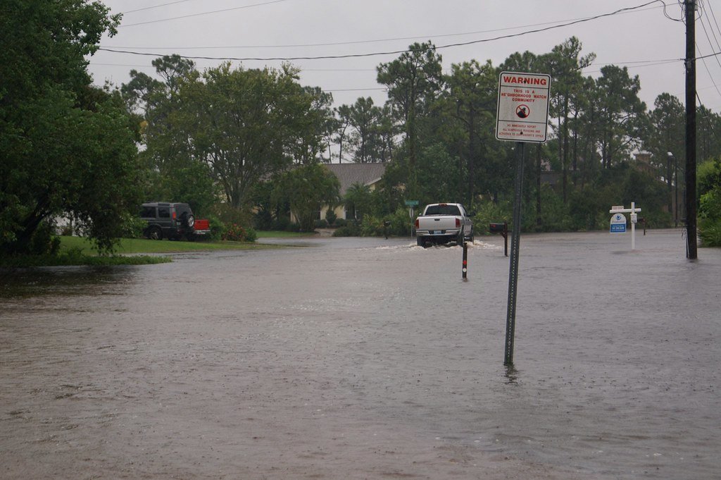
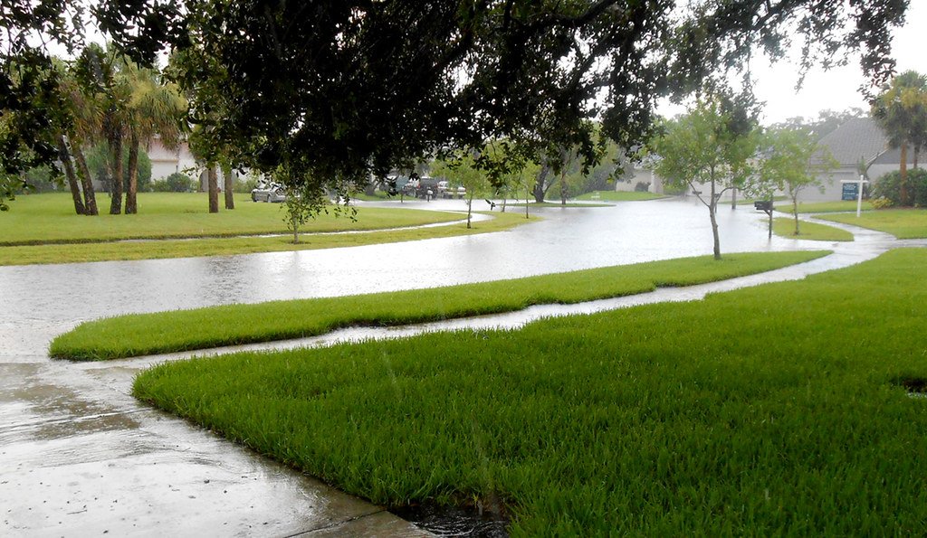
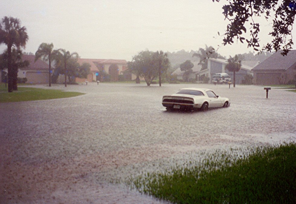
Emergency crews in Brevard carried out at least two water rescues in Cocoa and Rockledge in the early hours, and reports of flooded roadways grew through the morning, with cars stalling out in standing water in Melbourne. Florida Today reported that neighbourhoods in Cocoa and Rockledge had been cut off by feet of standing water, with vehicles abandoned and water entering homes.
Schools Shut, Port Address Postponed
The flooding brought daily life across the Space Coast to a halt. Brevard Public Schools closed on Thursday, along with schools in Indian River, Broward, Miami-Dade and Volusia counties — Volusia closing for Thursday and Friday. Florida Tech cancelled all classes and activities, as did Eastern Florida State College, which shut all of its campuses.
The closures came barely two weeks after the district shut for three days, from 2 to 4 November, when nearly two feet of rain fell on parts of the county. Palm Bay’s mayor, Rob Medina, told residents on Wednesday to stay home and avoid travel as the city faced renewed severe weather through the end of the week.
Port Canaveral postponed its annual State of the Port address, due to be given by chief executive Capt. John Murray, because of the severe weather and in the interest of public safety. A new date has not been set, and the Malcolm McLouth fishing pier was closed.
For a county still drying out from the last deluge, the second shutdown in a fortnight is a measure of how exceptional this rain has been.
The System Behind the Rain — and What Comes Next
The rain is being driven by a developing low-pressure system off Florida’s east coast. The National Hurricane Center was giving the system a 60 per cent chance of developing into a tropical or subtropical system over the weekend as it moves up the coast, with the next name on the list being Kyle. The non-tropical low was forecast to form off the coast by late Friday.
Even if the system never becomes a named storm, its impacts are already being felt: localised major beach erosion, minor to moderate coastal flooding, and rainfall that could cause urban flash flooding at times. Additional rounds of heavy rain are expected on Thursday and Friday, with 3 to 6 inches more possible in some locations along the peninsula.
The same kind of storm surge and heavy rain warnings that have accompanied cyclones elsewhere this month show how quickly a coastal weather system can turn from a forecast into an emergency — and in Brevard, that turn has already happened.
What Residents Are Being Told
Officials are urging residents not to drive through flooded roads, where the depth of the water and the condition of the road beneath it cannot be seen. The message, repeated by emergency managers across the county, is the familiar one: turn around, do not drown.
With the river forecast to stay above its old record into the weekend, the danger is not over when the rain eases. River flooding lags behind rainfall, and homes near the St Johns that stayed dry through the night may still take water as the crest moves downstream. Residents in the Lake Poinsett area and Silver Pines are watching the gauge as closely as the sky.
The record is broken, the rescues are under way, and the river has not finished rising — Brevard’s flood emergency is now measured in days, not hours.
By The BNN Media
The Best News Network
News Beyond the Borders